Hurricane Milton 10/9/2024

After monitoring the storm for a week, Hurricane Milton finally made landfall in Siesta Key near Sarasota along Florida’s west central coast on Oct. 9, 2024, approximately 8:30 pm EST. The Category 3 storm struck FL with winds of 120 mph before weakening to a Category 2 as it came ashore.

Click the satellite image below to see animation, 24 images – 5-minute update.
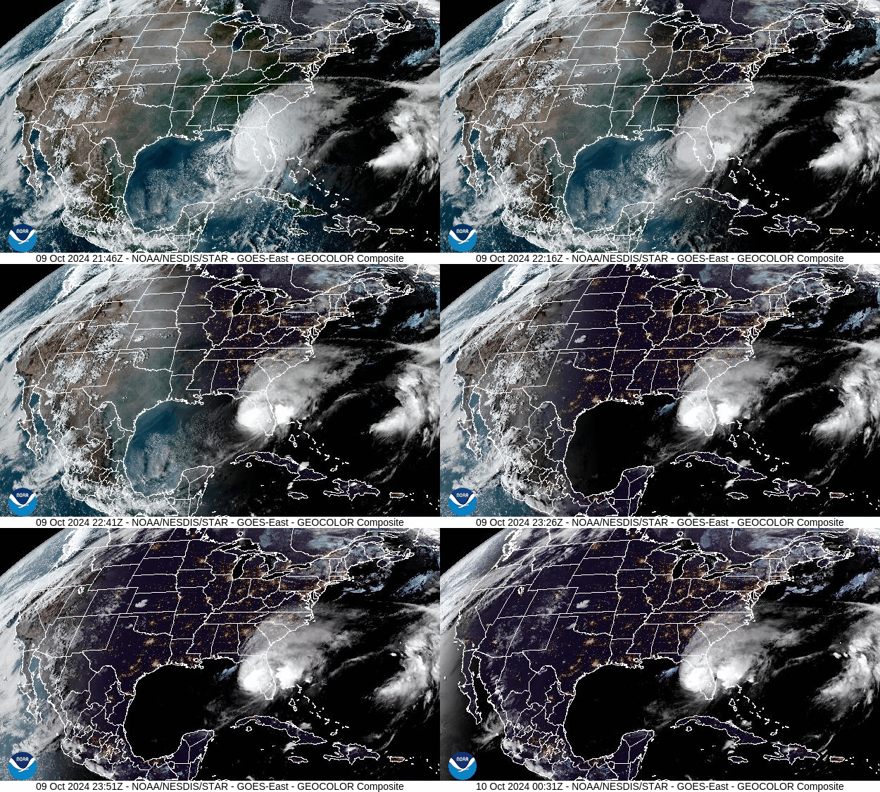
GOES-East CONUS – GeoColor – NOAA / NESDIS / STAR
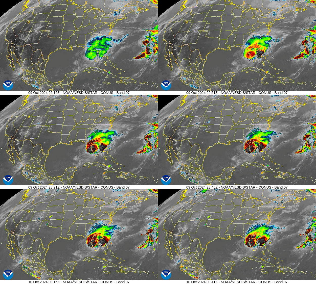
GOES-East CONUS – Band 7 – NOAA / NESDIS / STAR

We have been monitoring Hurricane Melton and preparing the worst scenario to protect our property since 10/2/2024.  There were many so called spaghetti models presented by the news media. Major model, GFS model, Global Forecast System, was shifting time to time for Hurricane Milton forecast. Another computerized model, Euro Model, European Center for Medium-Range Weather Forecast was consistent on forecast and observation. It took days for the two models to finally agree that the where on the west coast the storm would make landfall.  
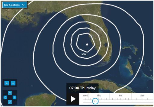
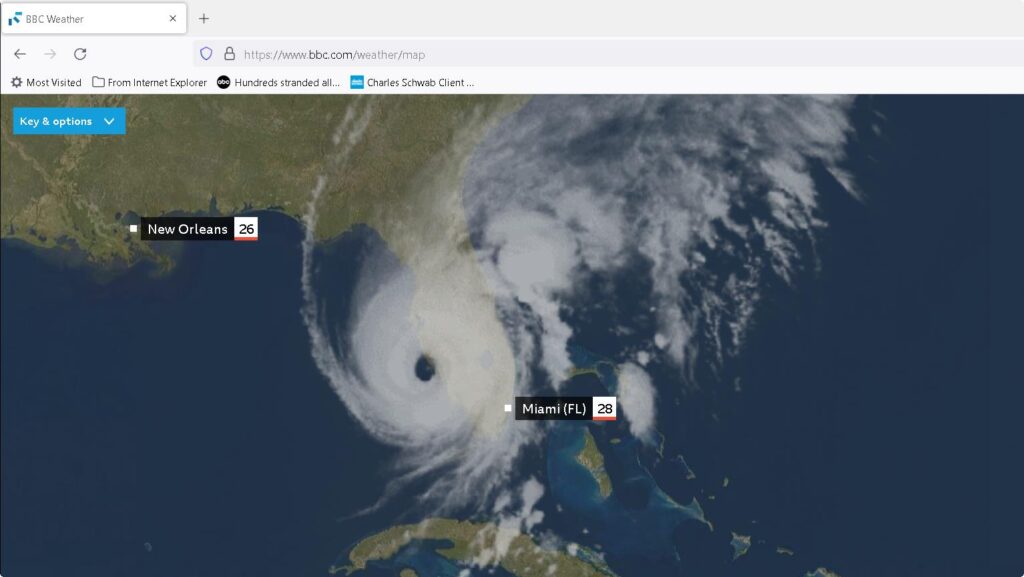
EURO Model on BBC weather website, landfall position note this site provides time GMT

We were lucky this time.  There were no major issues such as power outage, falling trees at our property.

https://www.wunderground.com/hurricane/atlantic/2024/hurricane-milton

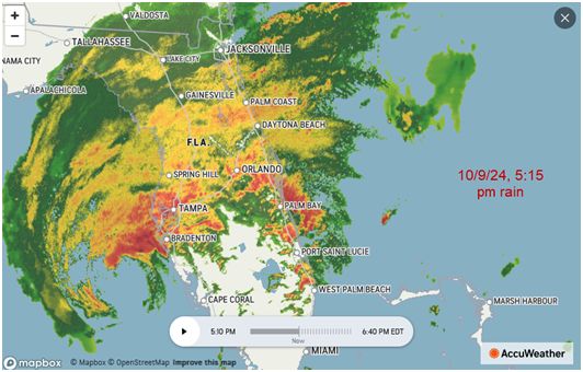
The National Weather Service (NWS) in Miami issued a tornado watch and several tornado warnings for parts of Florida as Hurricane Milton rapidly approaches west-central Florida. We had heavy rain and wind at 2:00 pm due to tornado touchdown in tradition and other location.

The tornado watch remained valid until Wednesday evening at 9pm ET and covered parts of south Florida including Miami, Key Largo, Tampa, Port St Lucie, Jupiter Farms, Sebring, Sebastian, Sarasota, North Port, Cape Coral and Bonita Springs and more,

The major impact for the Treasure Coast and counties South was the tornado that came as the feeder bands reached the East coast of Florida as the storm traveled up the West coast.  The Tornadoes that did touchdown (which there were numerous) created a lot of damage and even flipped at least four 18 wheelers on RT 95 and the turnpike. It has also been reported that a number of people did die as a result of a Tornado.

Important storm tracking links:

https://www.nhc.noaa.gov/     National Hurricane Center

https://www.bbc.com/weather/map  EURO model, European Center for Medium-Range Weather Forecast

Melbourne, FL Weather Radar | AccuWeather

www.wunderground.com 

Hurricane Idalia 2023

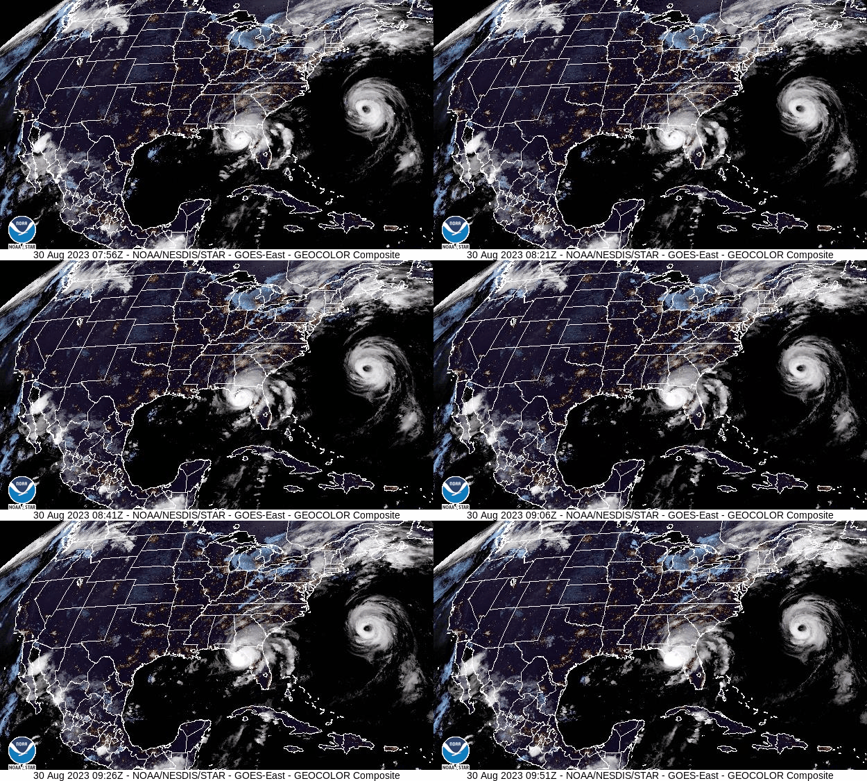
GOES-East CONUS – GeoColor – NOAA / NESDIS / STAR

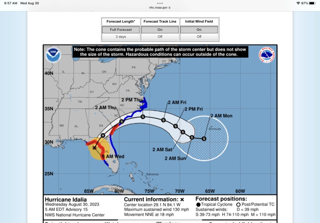
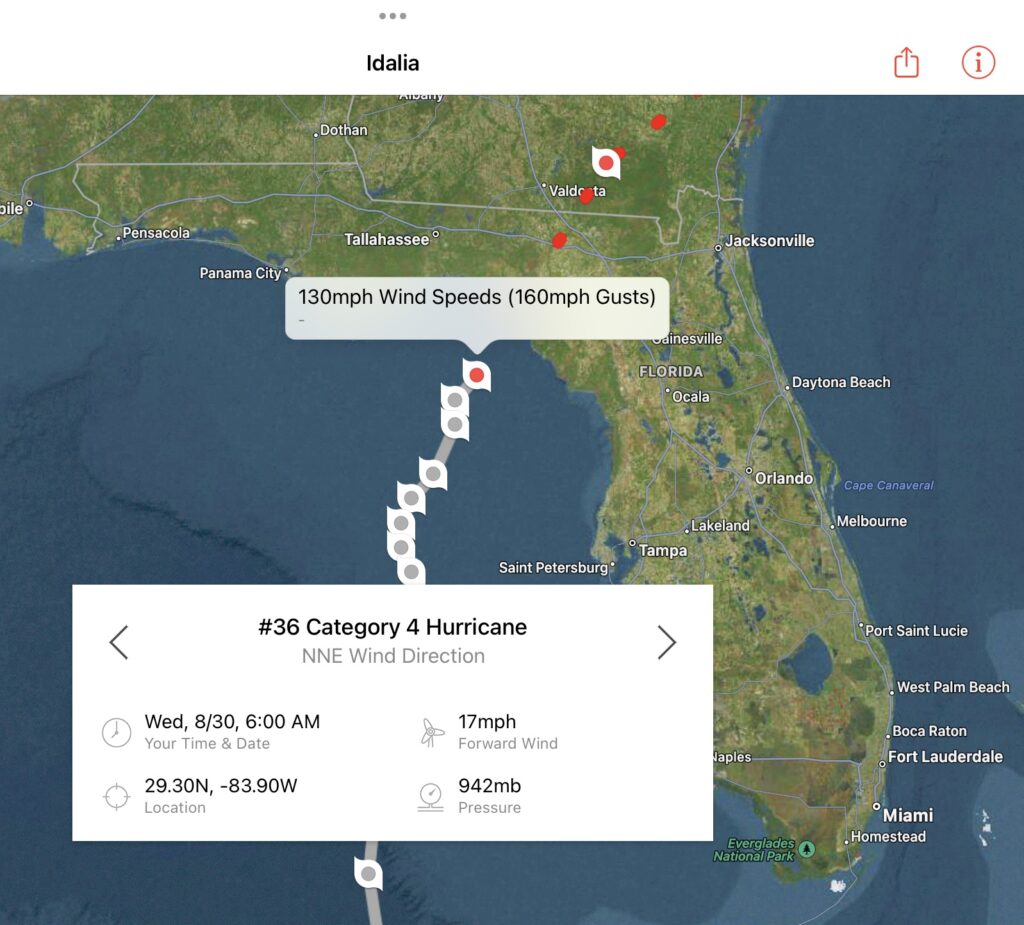
Hurricane Idalia made landfall in North West Florida just before 8 a.m. ET, August 30, 2023, with maximum sustained winds of 125 mph, Category 4 hurricane.

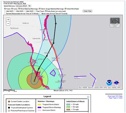
NHC is using a combination of 5-6 computer models including GFS model, Global Forecast System. 
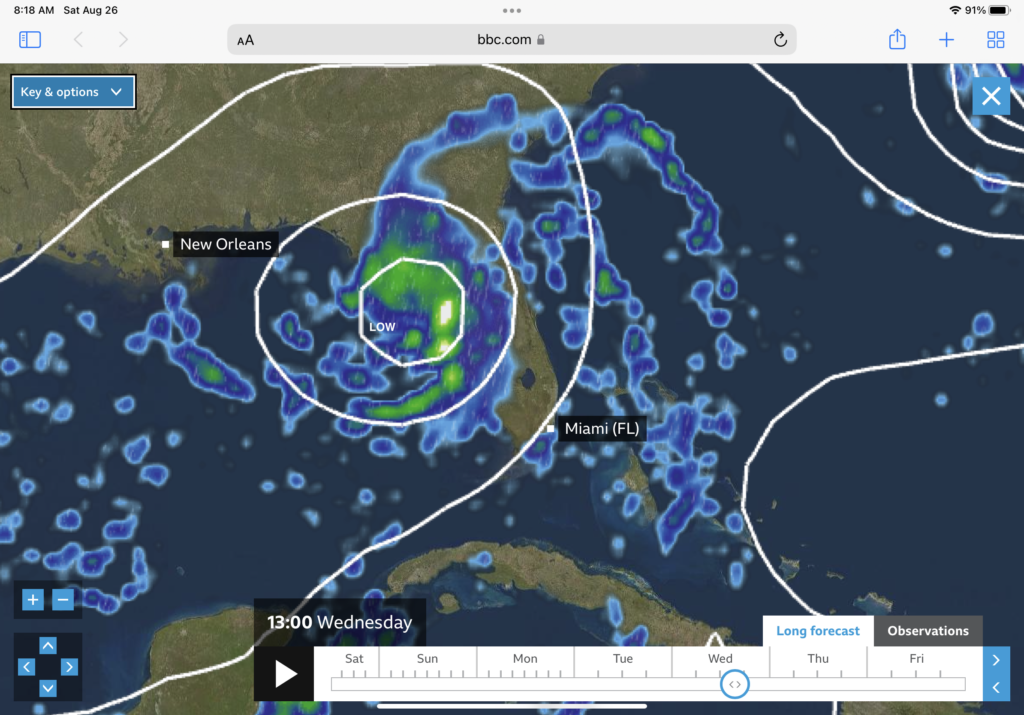
EURO Model on BBC weather website, landfall position note this site provides time GMT

More on Hurricane Idalia

Storm surge damage may stretch about 200 miles along Florida’s west coast, past the Tampa Bay area, and the state’s Big Bend area could get 12-16 feet of storm surge.

The National Weather Service office in Tallahassee said “locations may be uninhabitable for several weeks or months” because of wind damage. Storm surge could prevent access, too.

Important storm tracking links:

https://www.nhc.noaa.gov/     National Hurricane Center

Florida Power Outages Map Provides up to date power outages throughout the state. Also, FPL.com/outage

Hurricane & Tropical Cyclones | Weather Underground (wunderground.com) Weather underground for severe weather

https://www.bbc.com/weather/map European world weather, zoom in to US.

Dr Andrew Weil’s Curried Cauliflower Soup Recipe (Dr. Oz)

Full of antioxidants and a “True Foods” creation, Dr Andrew Weil gives us his recipe for curried cauliflower soup. He said it includes foods from all five categories on his anti-inflammatory diet.

Dr Andrew Weil’s online recipe was modified as follows:

Ingredients

  • 1/3 cup raw cashews (Use blender / Chopper)
  • 3/4 cup water or Vegetable broth
  • 3 tsp extra virgin olive oil
  • 1 medium onion, diced sautéed
  • 1 large head cauliflower, cut into 1-inch pieces (use submersible blender)
  • 1 14-oz can light Coconut milk
  • 2 tbsp Curry powder
  • 1 tsp ground Turmeric
  • 1 tsp ground Cumin
  • 1 tsp evaporated can sugar
  • 1/4 tsp ground Cinnamon
  • 1/4 cup chopped fresh cilantro
  • Unsalted butter to sauté onion
  • Sea Salt for flavor

Add when ready to serve

  • Chopped carrots
  • Chopped Celery
  • Chopped Green onion (Scallion Onion)

Direction:

  • sauté onion
  • Use blender for raw cashews add some coconut milk at this time
  • Add cauliflower, coconut milk, blended cashews, spices and salt as needed
  • Place all in large pan, cover all with rest of coconut milk, water or vegetable broth
  • Bing to a low boil and cook for at least 10 min
  • Use submersible blender to mix thoroughly.

Now if you do not have a submersible blender, any blender will do. I would just assume that all households that have the needed kitchen appliances have the submersible blender, or those that are now getting married include on their wish list of items for wedding gifts..  Note the blender used by most will have to be filled with a boiling hot soup (as one needs to bring the cauliflower soup to a boil for 10 min) just to cook the cauliflower.. I used a potato masher prior to using the submersible blender just to break up the cauliflower heads.  The taste is great, and one can barley tells there is any spice at all added.  I encourage all try as it is very healthy, and it makes a great lunch soup..  

submersible blender

Hurricane Nicole 11/10/2022

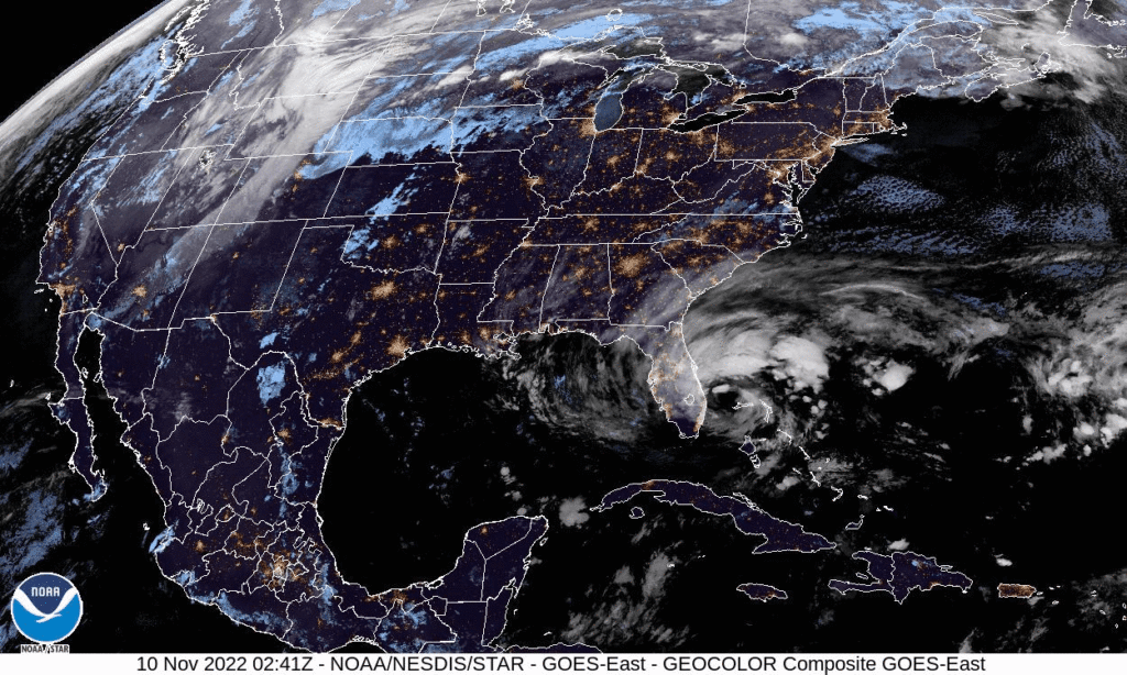
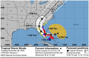
Since living in Fl, we know that the actual hurricane season goes through Nov.  Well, here it is Nov. 10th and Hurricane Nicole come to the treasure coast as Category 1 storm with winds of 75 mph.  This is actually rare for a November hurricane to come ashore on the East coast of Fl this late in the season.  Well, Nicole made landfall on Hutchinson Island close to Vero Beach, Florida, at 3:00 am EST On Nov. 10, 2022.

Click the satellite image below to see animation, 24 images – 5-minute update

GOES-East CONUS – GeoColor – NOAA / NESDIS / STAR

Band 7 GOES-East CONUS – Band 7 – NOAA / NESDIS / STAR

Again, we were lucky this time, did not lose power.

Important storm tracking links:

https://www.nhc.noaa.gov/     National Hurricane Center

Florida Power Outages Map Provides up to date power outages through out the state

Hurricane & Tropical Cyclones | Weather Underground (wunderground.com) Weather underground for severe weather

After Hurricane Ian Cleanup Work, 9/29/2022

The wind picked up early in the morning. As a direct result of the increased winds, all the trees were bowing down.  Peak winds of 20-30 miles per hour and gusts up to 50 miles per hour in St Lucie County inland area were reported at approximately 5:00 am, 9/29/2022

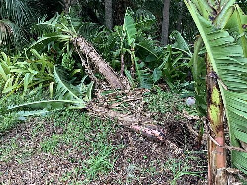
It was a mess in our back yard.

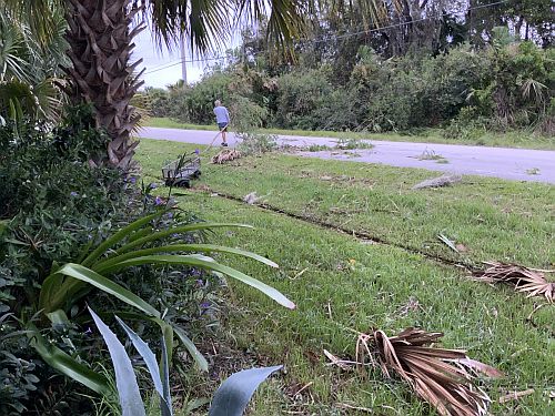
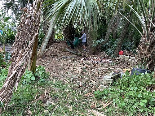
We started the cleanup of the tree branches, banana trees, cabbage tree branches and eureka branches.  The branches were even on the street so, they were also picked up. Maybe we should just cut down some of the trees before the next storm.

Some of the tree branches could be chopped using a woodchipper.  It will take a couple of more days to complete cleanup work

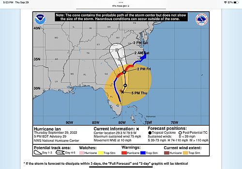
As 5:00 pm, 9/29/2022, Ian is once again a Hurricane from winding down to a tropical storm as it went over Orlando, once it crossed into the Atlantic, the winds increased to hurricane force and was focus on a different state..

Hurricane Ian 9/28/2022

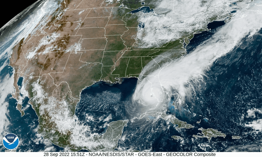
After monitoring the storm for a week, Hurricane Ian finally made landfall over Sanibel Island and then Fort Myers, in SW Florida on Sep. 28, 2022, approximately 2:00 pm EST. Click the satellite image below to see animation, 24 images – 5-minute update.

GOES-East CONUS – GeoColor – NOAA / NESDIS / STAR

Notice the eye of the storm forming

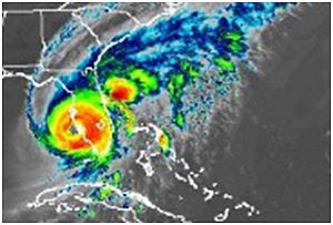
NWS Southern Region Tropical Webpage (weather.gov)

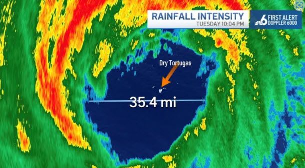
The eye of Hurricane Ian over the Dry Tortugas on Tuesday, Sept. 27, 2022.
Hurricane Ian Forms New Eye as It Approaches Florida: John Morales – NBC 6 South Florida (nbcmiami.com)

9/28/2022, 2:00 pm, Hurricane Ian, a strong Category 4, almost Category 5, with around 155 mph wind speeds, moving north-northeast at 9 mph.

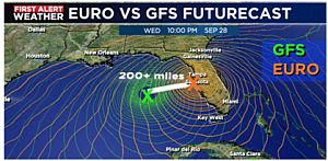
We have been monitoring Hurricane Ian and preparing the worst scenario to protect our property at same time since 9/21/2022.  There were many so called spaghetti models presented by the news media. Major model, GFS model, Global Forecast System, was shifting to west every day for sometimes. Another computerized model, Euro Model, European Center for Medium-Range Weather Forecast had been consistent to make landfall on the west coast of Florida.

It took days for the two models to finally agree that the where on the west coast the storm would make landfall.  
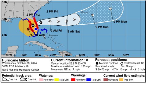
EURO Model was originally 200+ miles east of the GFS Model prediction

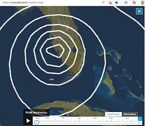
EURO Model on BBC weather website, landfall position note this site provides time GMT

NHC is using a combination of 5-6 computer models including GFS model, Global Forecast System. 

We were lucky this time. Tropical storm-force winds of 36 miles per hour and over 8 inches rain in some locations of St Lucie County reported 12:00 am, Wednesday, 9/28/2022. 

Important storm tracking links:

https://www.nhc.noaa.gov/     National Hurricane Center

https://www.bbc.com/weather/map  EURO model, European Center for Medium-Range Weather Forecast

Port St Lucie, FL hurricane | Microsoft Weather (msn.com) Port St Lucie Hurricane web site

NWS Southern Region Tropical Webpage (weather.gov)

https://arcg.is/195nuP0 Florida evacuation map

Florida Power Outages Map Provides up to date power outages through out the state

Hurricane & Tropical Cyclones | Weather Underground (wunderground.com) Weather underground for severe weather

Continue to Making Fire Cider at Home

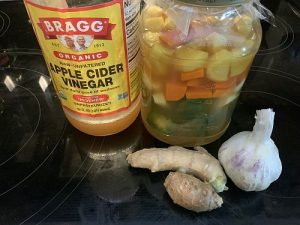
I have been using fire cider for more than 5 years, especially during almost 2 years long pandemic.  Here is the recipe: http://www.mommypotamus.com/fire-cider-recipe/

Also, there are some notes as addition of our 2016 posting, http://www.jnlyman.com/blog/2016/04/15/fire-cider-home-made-natural-remedy/

* I did not use onion, lemon and rosemary which float on top of the vinegar and may create an issue of spoilage.  So I used more turmeric and ginger root.

* Since I did not use fermenting weight to hold down the veggies, I put hot peppers first, then garlic, turmeric and ginger to prevent light veggies floating.

* Shake once a day to prevent spoilage

Enjoy

Green Orchid Grammatophyllum Scriptum at Our Back Yard

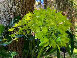
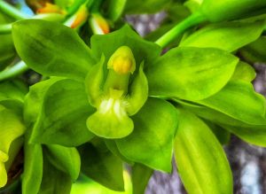
We received a free orchid, (Grammatophyllum Scriptum) from Port St Lucie Orchid Society almost 3 years ago during a class discussing orchid division. Now the orchid is in full bloom with 2 long flower spikes and many amazing waxy, light greenish-yellow flowers that have a sweet fragrance. As of July 26 2021, the length of the flower spike was approximately 2′ 10″ and size of the flower was 1.5″.  Green petals and sepals of the flower have slightly dark strips from the base to tip. The flower lip is short with median lobe of the lip rectangular.  Two yellowish, round pollinia almost covered by light-green anther cap are solid, waxy and colorful.  Magnificent and beautiful!

This Grammatophyllum is first time blooming at our yard.  Unfortunately it does not bloom often like other orchids.  It only blooms every 2-4 years, and the bloom may last 1-3 months. We will see.
There are 13 species of Grammatophyllum. One of the specie is Grammatophyllum Speciosum, the largest orchid in the world, so called tiger orchid.

For more information: Grammatophyllum (aos.org)

Another Night Flower, Epiphyllum Oxypetalum Blooming, July 10, 2021
We had an opportunity to watch and make time lapse video of night flower, Epiphyllum Oxypetalum bloom on July 10, 2021.  What a surprise.  Total eight buds opened at same time.  It started to open around 8:00pm and took only two and half hour to reach full bloom with beautiful flower and amazing fragrance.  A real strong stink 🙂 !

Making Eggplant Parmesan

Ingredients

  • 2 large eggplants (note, over ripe eggplant has a lot of seeds)
  • 1 tablespoon extra virgin olive oil to sauté onion
  • minced garlic according to taste
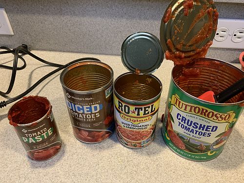
  • make your own special receipt sauce, we use crushed tomatoes, diced tomatoes, chili and chive diced tomatoes, and tomato paste along with onion, oregano pepper and a dash of sugar.
  • Freshly ground black pepper
  • sufficient breadcrumbs for dredging
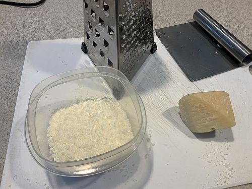
  • 1 1/4 cups grated parmesan cheese, divided between layers and top
  • all-purpose flour as needed
  • 6 large eggs, beaten (more if needed) for dredging process
  • 1/4 cup extra virgin olive oil for top of eggplant slices prior to baking.

Direction

Make your sauce:

Sauté onion and garlic in olive oil.  Then add tomato ingredients according to desired taste.

Grated  parmesan cheese (fresh):

Prepare eggplants:

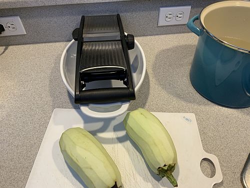
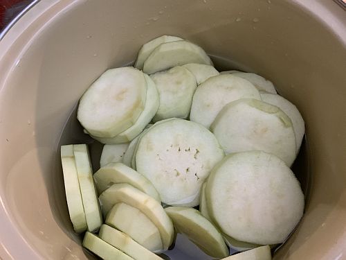
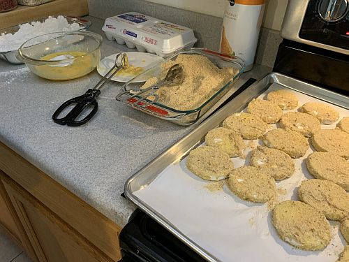
Peel the eggplants leaving the stem on so you can hold easily when ready to slice with mandolin. Slice the eggplants with mandolin and then place the sliced eggplants in water to keep moist prior to dredging step.

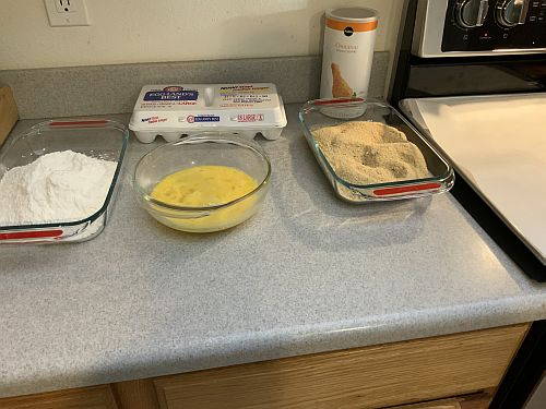
Dredge the eggplant in flour, egg, and breadcrumbs (set up dishes ahead of time for preparation).

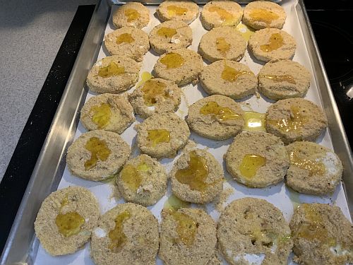
After the dredging process, and the slices are on the parchment paper, drizzle a little oil over the top of each piece prior to placing in oven for 17 min. at 360 degrees F. Take out , turn and place in oven for an additional 17 min.

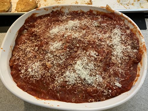
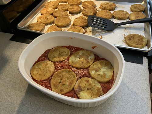
Spread the 1/4 tomato sauce over the bottom of casserole dish, sprinkle with grated cheese, then place the first layer of eggplant round covering the sauce on the bottom of the dish. Repeat the process for two additional layers finishing by placing the remaining sauce on the top.  Note, there should not be more than three layers. Sprinkle the remaining grated cheese on top and place in a 350 degree F oven for 35 to 40 min.

Final results of baking process, and set aside for a minimum of 30 min prior to eating.

You can tell when done as sides break away slightly and the cheese is melted.  Also you may notice some boiling of the sauce on the sides while in oven.